Sitemap Navigation Skip to Content
RI SealOfficial State of Rhode Island Website
YouTubeFacebookXeNewsletter SignUp
CRMC Logo

RI Coastal Resources Management Council

Dredging

Proposed Providence River Dredging and CAD Cell Creation

CRMC is coordinating with the USACE to perform another Providence River dredging event to bring the shipping channel back to its authorized depths and widths. This project would include the construction of a Confined Aquatic Disposal (CAD) Cell in the Edgewood Shoals Area. The CAD Cell would be utilized for disposal of dredged material within the Providence River Shipping Channel, various shallow draft Federal Navigation Projects (FNP), and additional capacity for non-federal projects with disposal managed by CRMC over the next 20 years.

For more information visit the Army Corps of Engineers project page

Waterplace Park and Providence River Dredging Project

Dredge cutter
PHASE 1, 2019-2020

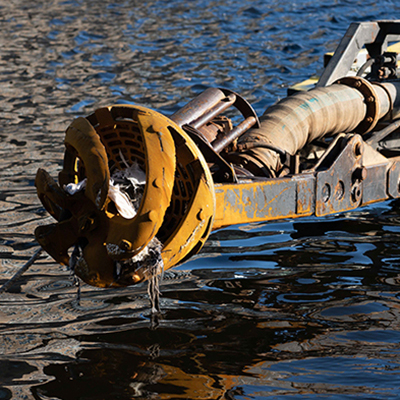
Removed material from the Amtrak bridge under the Providence Place Mall to the Crawford Street Bridge piers

Dredge barge
PHASE 2, 2022-2023

Maintenance dredging of the upper Providence River from the Crawford Street Bridge to the Point Street Bridge

Past Providence River Dredging

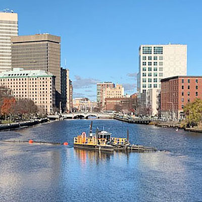
The last significant dredging of the Providence River Shipping Channel was completed in 1971 by the Army Corps of Engineers (USACE), the federal agency responsible for its construction and maintenance. Since that time, a significant reduction in channel water depth and channel width occurred, a result of sedimentation in the channel, which prompted the US Coast Guard to restrict large vessel traffic to one-way passage for safety. In 1996 the CRMC was tasked with the responsibility on behalf of the state to coordinate the USACE's efforts to maintain this channel's authorized navigable depths and by 2003 the shipping channel was dredged back to its authorized depths and widths.

Army Corps of Engineers New England District

Harbor of Refuge Federal Navigation Dredging Project, Point Judith, RI

The work included maintenance dredging of the 15-foot-deep entrance channel into the harbor, as well as the eastern and western branch channels and the channel leading into Point Judith Pond. The channel had not been dredged since its construction in 1977. Natural shoaling reduced the channels’ depth over the years, making navigation hazardous during low tides. Approximately 90,000 cubic yards of sand was removed from about 25 acres of the area, and restored the entrance channel and other channels to original depths and dimensions, according to the USACE. The dredged material was used to help replenish a near-shore sandbar off Matunuck Beach in South Kingstown.

Army Corps of Engineers Fact Sheet (PDF)

Sachuest Point Landfill Remediation and Saltmarsh Restoration Project

Narrative Report, Sachuest Point Landfill Remediation and Saltmarsh Restoration Project (PDF)
Trash trailer

CRMC Trash Trailer

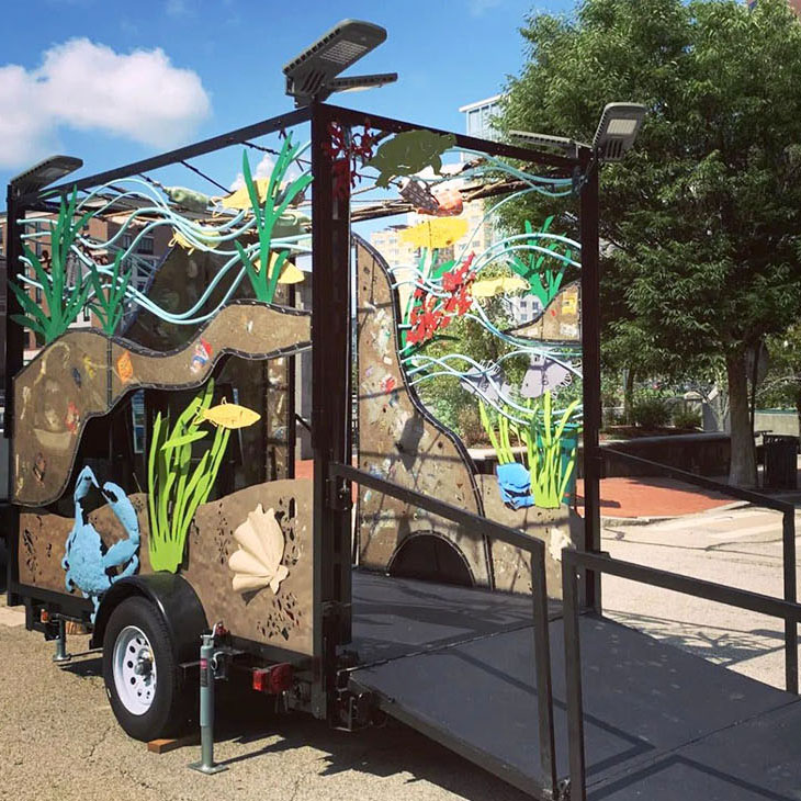
Trash and debris collected from the dredging of Waterplace Park and adjacent section of the river into a traveling educational art installation

RV Jack Reed

R/V Jack Reed: Funding and Uses

  • The CRMC is required, as a permit condition and memorandum of understanding with the U.S. Army Corps of Engineers, to monitor and report on usage of the CAD cells annually. CRMC staff uses the R/V Jack Reed to survey them once a year and also monitor the placement of material into the cells. Disposal locations are adjusted based on results of these surveys to more effectively managed the CAD cells. This involves weekly surveys during the dredge season to provide timely feedback to dredging contractors so disposal plans can be adjusted as needed. The CRMC also monitors the federal channel adjacent to the CAD cells to ensure disposed material does not stack up above authorized channel depths;
  • The CRMC provides survey services for municipalities to support their dredging efforts as well as RIDEM and Save The Bay;
  • The CRMC uses the R/V Jack Reed for harbor management projects. The advanced on-board GPS can determine encroachments in real time as well as accurately determine the best limits for reauthorization requests;
  • The CRMC provides support for the U.S. Army Corps of Engineers for reconnaissance studies and access to breakwaters, as well as the U.S. Coast Guard as needed;
  • The CRMC uses the on-board GPS to inspect all aquaculture sites for compliance annually;
  • The CRMC works with the University of Rhode Island and other partners to conduct other work including complete bottom habitat mapping, as well as mapping the sub-bottom geology. These maps help us for near shore dredge material placement; and
  • The CRMC is also able to monitor ongoing non-federal dredging and disposal projects, and ensure compliance of other projects/operations by making weekly site visits and day trips. For example, the CRMC worked with the City of East Providence to provide survey services to re-install the day markers that were removed as part of the Bullocks Cove dredging, saving the city approximately $5,000.

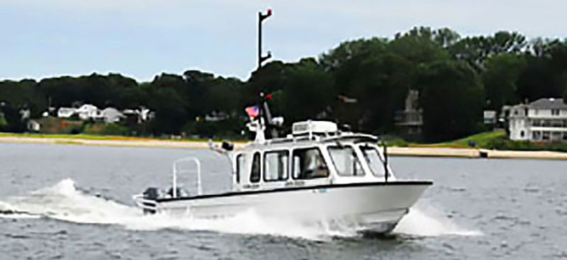
The CRMC is also able to monitor ongoing projects like the submarine disposal, federal dredging and disposal projects, and ensure compliance of other projects/operations by making weekly site visits and day trips.


Stedman Government Center, Suite 3
4808 Tower Hill Road
Wakefield, RI 02879-1900

Voice: (401) 783-3370
Fax: (401) 783-2069

Office Hours:
Monday – Friday
8:30am – 4:00pm