Sitemap Navigation Skip to Content
RI SealOfficial State of Rhode Island Website
YouTubeFacebookXeNewsletter SignUp
CRMC Logo

RI Coastal Resources Management Council

Shoreline Change Maps

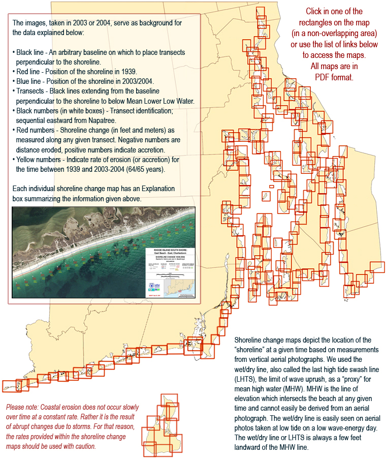
The purpose of these maps is to show shoreline rates of change that will be applied to pertinent sections of the Council’s regulatory programs to address issues including setbacks of activities from coastal features.

Shoreline change index map which allows users to locate a section of shoreline on the map and click on it to link to a PDF map of that section.
Block Island (2017)
Washington County (2016)
Kent, Providence, Bristol and Newport Counties (Narragansett Bay and Islands)

Stedman Government Center, Suite 3
4808 Tower Hill Road
Wakefield, RI 02879-1900

Voice: (401) 783-3370
Fax: (401) 783-2069

Office Hours:
Monday – Friday
8:30am – 4:00pm