![]()
![]()
![]()
![]()

RI Coastal Resources Management Council
...to preserve, protect, develop, and restore coastal resources for all Rhode Islanders
![]()
![]()
![]()
![]()
...to preserve, protect, develop, and restore coastal resources for all Rhode Islanders

Coastal Barrier Resources System Mapper and library of RI Maps
(US Fish & Wildlife Service Coastal Barrier Resources Act site)

STORMTOOLS
Maps of storm inundation with and without sea level rise for varying return periods for RI coastal waters.

Sea Level Affecting Marshes Model (SLAMM) Maps (adopted by the CRMC on January 13, 2015)

Freshwater Wetlands Jurisdiction
Once the map viewer loads click on the “Boundaries and Regulatory Overlays” layer and then choose “Wetland Jurisdiction”
(The CRMC and RIDEM collaborated on this legislatively-directed project that establishes clear delineations for the jurisdictional areas for freshwater wetlands. If your project lies on one side of the jurisdiction line, then you only need one agency to review the project.)


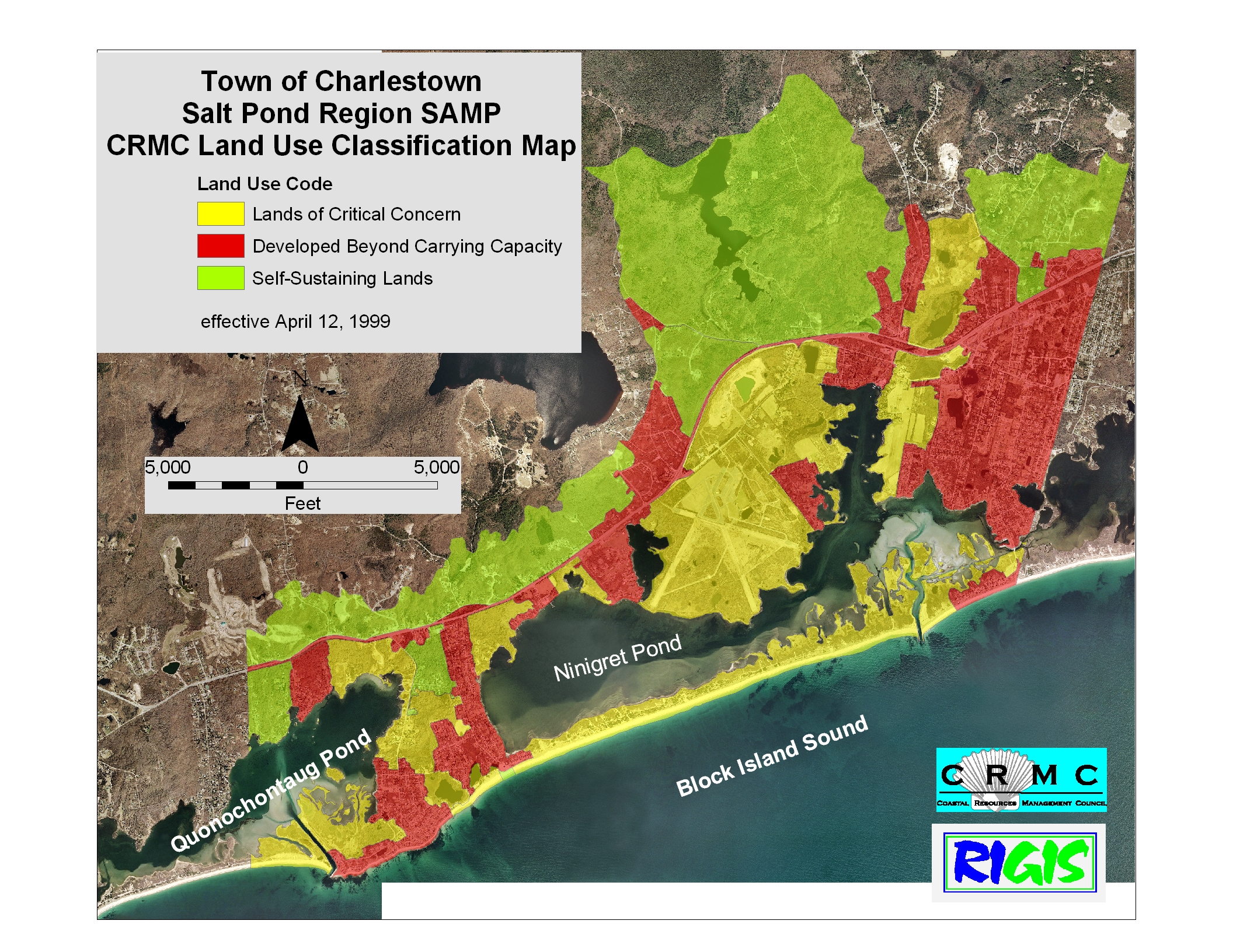
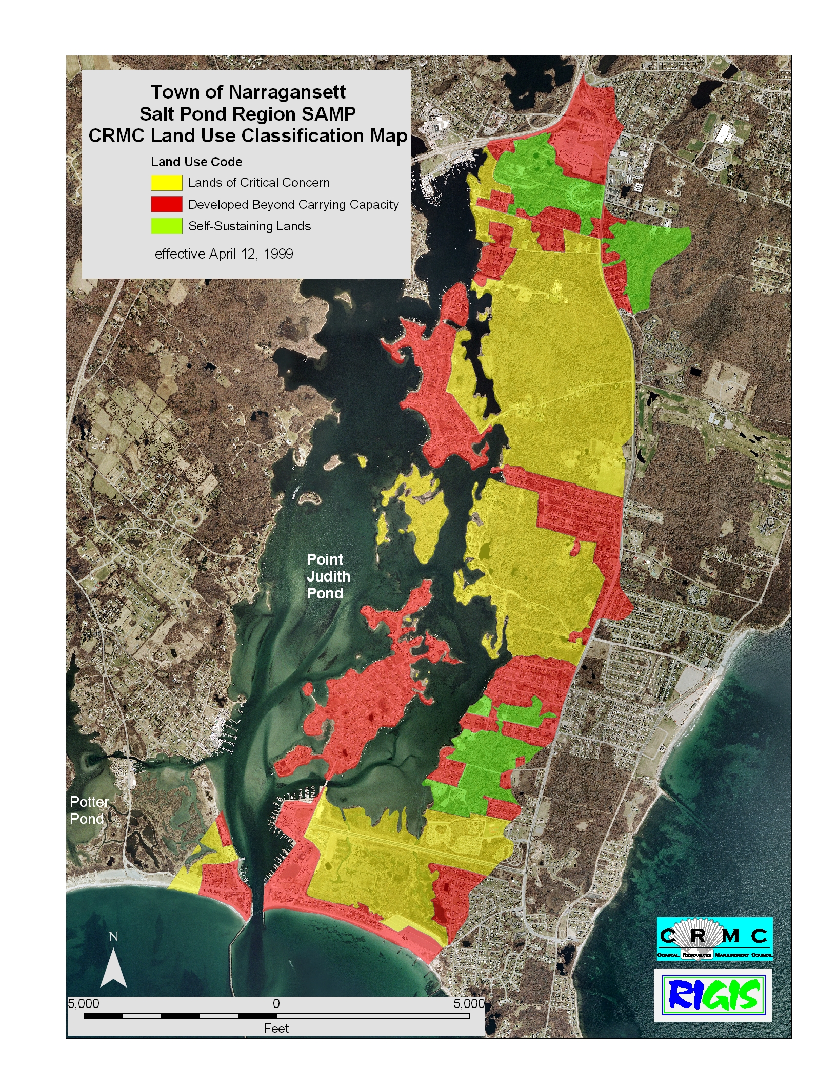
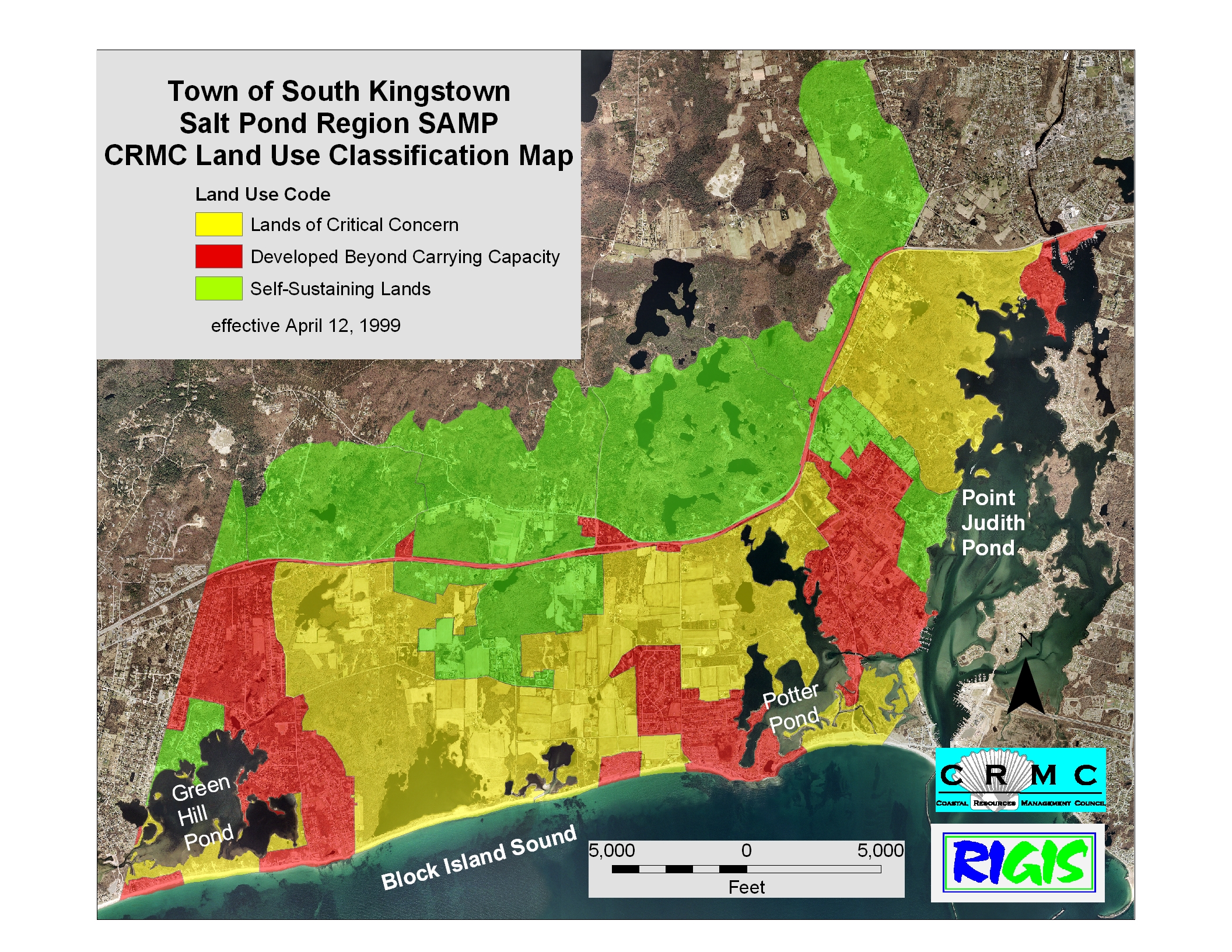
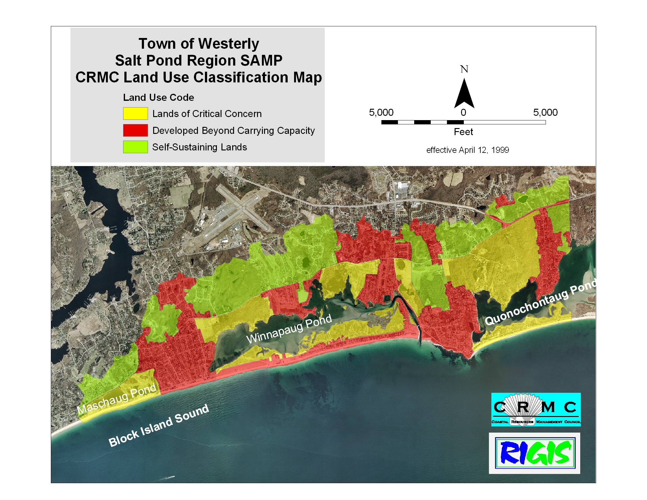
CRMC Land Use Designations
DEM Critical Resource Area boundary tool for Google Earth
| Salt Pond Region SAMP Charlestown Narragansett South Kingstown Westerly |
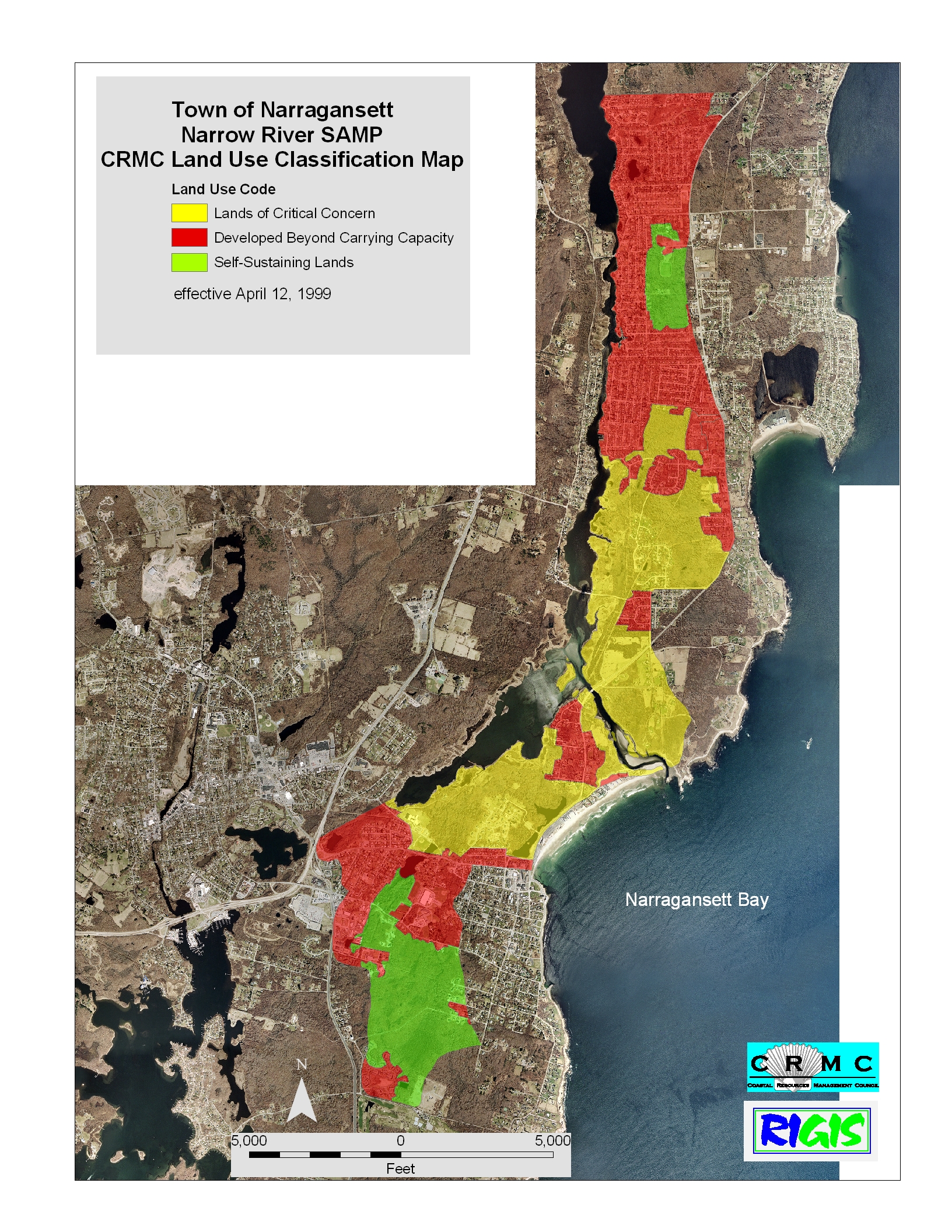
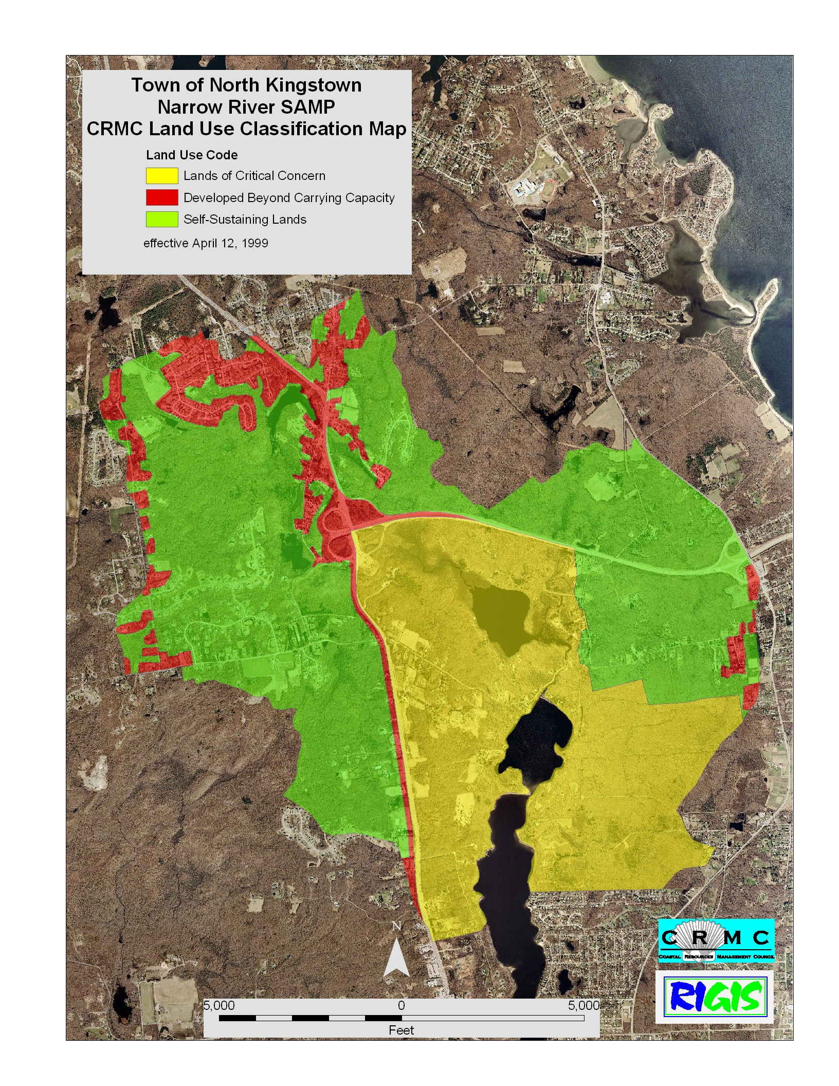
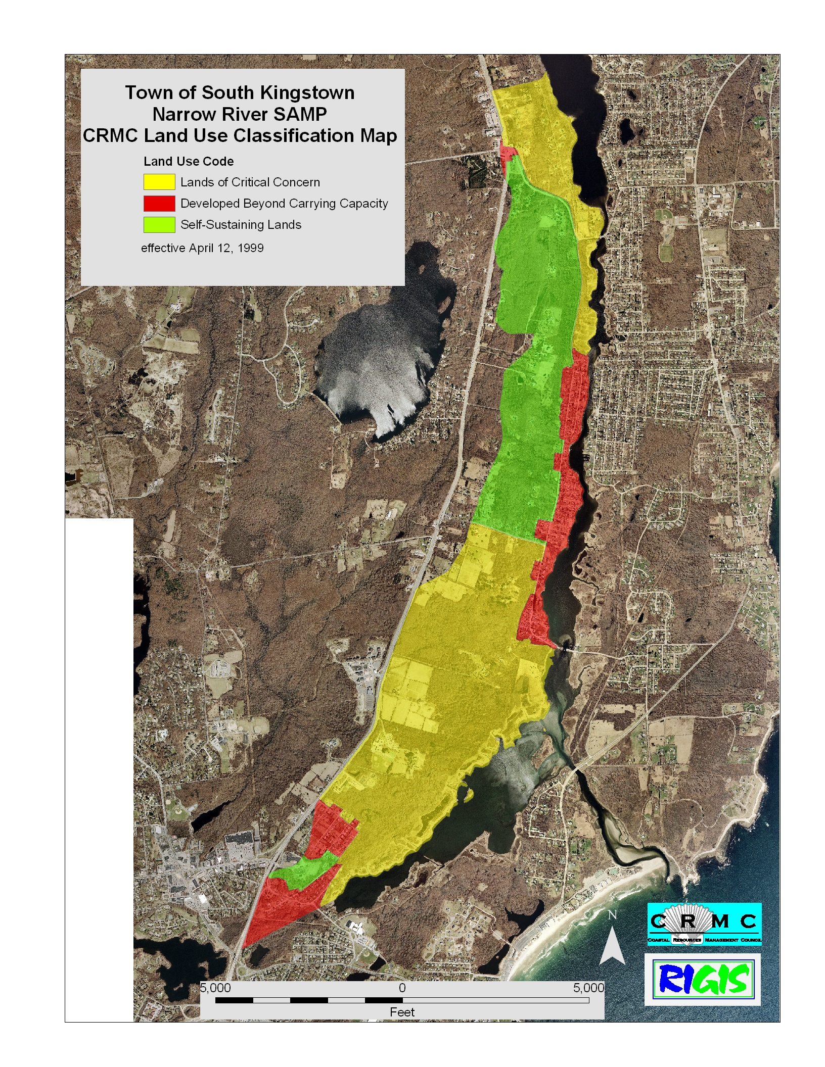
Narrow River SAMP Narragansett North Kingstown South Kingstown |
Stedman Government Center
Suite 116, 4808 Tower Hill Road, Wakefield, RI 02879-1900
Voice 401-783-3370 • Fax 401-783-2069 • E-Mail cstaff1@crmc.ri.gov
![]()
![]()
An Official Rhode Island State Website


